
Thank You San Mateo County!
Look beyond the Grand Jury Report
by Sabrina Brennan
The San Mateo County Harbor District's focus is shifting towards the needs of the community. This is why I ran for a seat on the Harbor Commission.
I've worked hard and made measurable progress while serving my first term. I'm happy to report that significant change has been accomplished; with new management in place we're becoming a well-run District. In 1976, when I was age 8, the District borrowed millions of dollars from the California Division of Boating and Waterways. In April 2016, the Harbor District repaid those loans. As board President I created the Finance Committee and I’m very pleased that the District is debt free for the first time in 40 years.
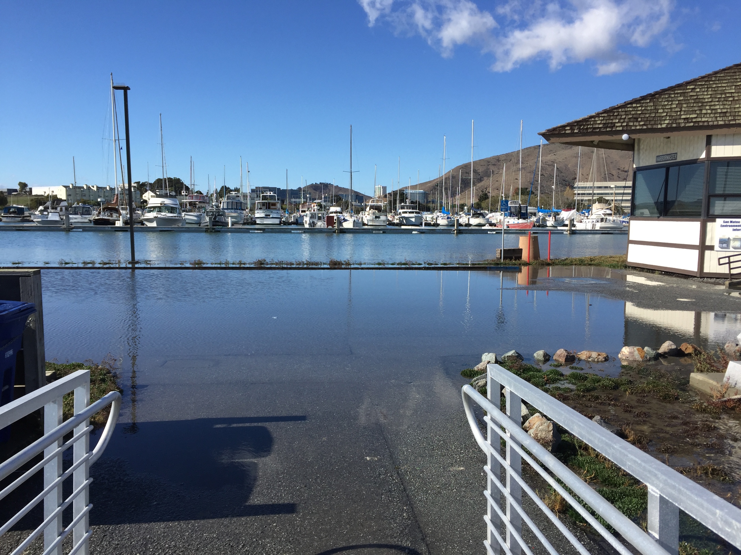
In May 2016, I organized a Sea Level Rise & Erosion Forum that included speakers from the U.S. Geological Survey and the U.S. Army Corps of Engineers. Over 175 people including city, county, and state representatives packed the Douglas Beach House to the rafters! We're fortunate to live in an area with an engaged electorate and strong leadership. In June 2016, our County Supervisors included $2.6 million in their approved budget specifically for erosion protection for businesses, Coastal Trail access, and homes near Mirada Rd. in Half Moon Bay.
In May 2015, we moved the District’s headquarters back to the Coastside, within sight of Pillar Point Harbor. In July 2015, the board unanimously approved the District’s first Code of Ethics & Values. In August 2015, President Mattusch and I were the first commissioners from our District to receive special district governance awards for completion of the California Special District Association Leadership Academy.
A recent Grand Jury report instructs the County Board of Supervisors to “look beyond” the Harbor District’s performance improvements. The report advises Supervisors to weigh in on early termination of the Oyster Point Marina/Park Joint Powers Agreement between the City of South San Francisco and the Harbor District. In May, a development agreement was signed by South City and Greenland USA, an international developer based in China, for a biotech business park located on the Oyster Point Landfill. The Harbor District currently operates the site as a public park and marina. The project was originally approved in 2011 and it includes 2.25 million square feet of office space, new roads, removal of existing roads, and grading for a new hotel site. The first phase of a three phase project will include 600,000 square feet of office/R&D space attached to a parking garage structure on approximately 10 acres.
A recent San Francisco Examiner article provided some insight into the Cities plans, “City Manager Mike Futrell noted Greenland is going to re-cap all of the landfill, including places where no construction is planned.” This is good news because portions of the landfill cap are submerged in the Bay. State environmental regulations require replacing the old clay cap.
In June, Greenland gave a presentation to the Harbor Commission. “This is a long-term project,” said development director Clara Tang. Regulatory hurdles are expected to take one year or more before construction can begin. Tang said the project could take 10 years to complete.
Concerns about lease revenue were raised. District management recommended leaving a bait and tackle shop vacant because there are too many unknowns about the development. Slip occupancy may dip as tenants relocate to avoid construction-related nuisances. A 2011 agreement between the City and the District grants the District 40,000 square feet of commercial lease space after development is complete. The $1.00 per year lease ends when the Joint Powers Agreement (JPA) expires in 10 years. District management concluded that a new agreement should be brought forward.
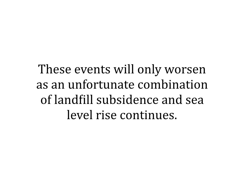
In May, Tetra Tech, consultants for South City, produced a flood protection report focused on landfill subsidence and sea level rise. The report discusses the City/County Association of Governments (C/CAG) interest in forming a Joint Powers Authority (JPA) to address sea level rise and it concludes that Oyster Point flooding is a regional issue. Measure AA has been identified as a possible funding source for addressing flooding caused by landfill subsidence.
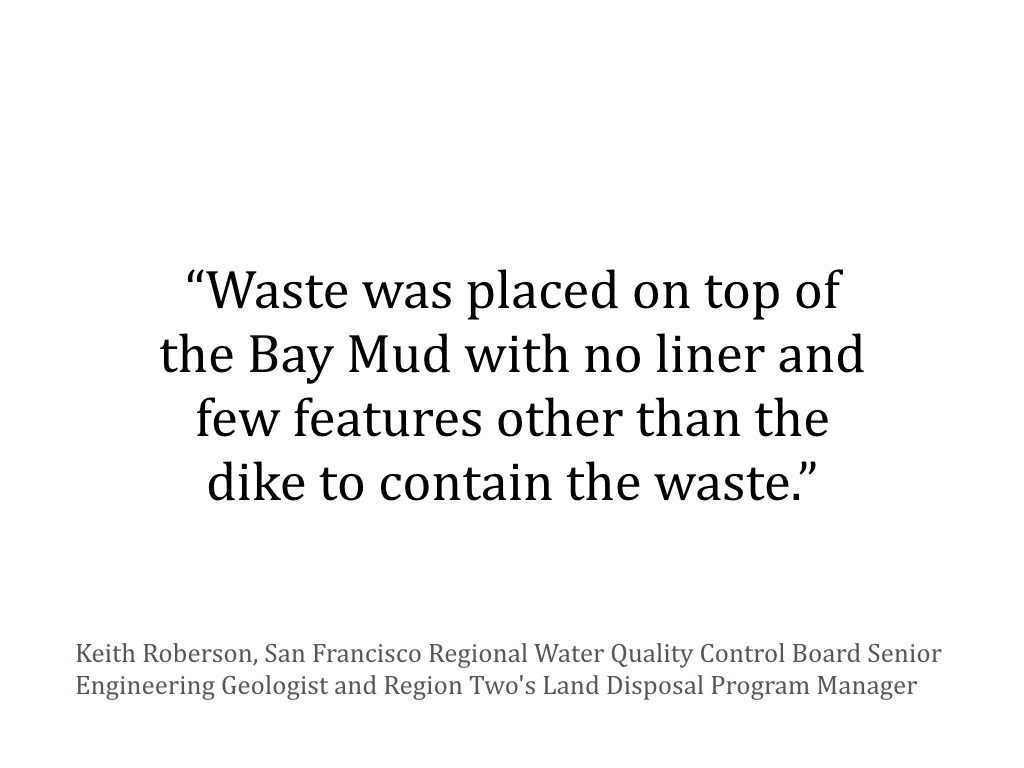
Oyster Point Landfill was in operation from 1956 to 1970. Consistent with landfill practices at that time, no liner was installed at the site. Waste disposal design features such as liners, cellular division of waste, and leachate collection systems were not installed. Instead, the waste materials were placed directly onto the Bay mud.
Around 1976, the closure of the City-owned landfill prompted local officials to make a deal with the Harbor District to obtain long-term funding for marina operations and improvements. In 1977, South City and the Harbor District entered into a Joint Powers Agreement (JPA) that terminates in 2026. As a result countywide property tax funds the City owned facility. Historically, Oyster Point Marina operating costs and capital improvements exceed operating revenue and the shortfall is funded with countywide property tax.
Pillar Point Harbor is one of the few commercial fishing ports in California and it’s owned and operated by the Harbor District. It’s located in an unincorporated area of the county; the District’s Harbor Patrol provides search and rescue emergency response, tenant occupancy rates are consistently high, and it’s the only harbor of refuge from Santa Cruz to San Francisco. The Half Moon Bay location provides ocean-dependent recreation and a local source for sustainable seafood. A strong case can be made for funding Pillar Point Harbor emergency response, repairs and improvements with countywide tax dollars. Maintaining a decades-old commercial fishing harbor in need of TLC is like owning a boat—things are always breaking and maintenance is required.
The Harbor Commission is moving in a positive direction, and with change comes creativity, innovation, improved accountability, opportunities to evaluate and define long-term goals, and the need for greater cooperation.
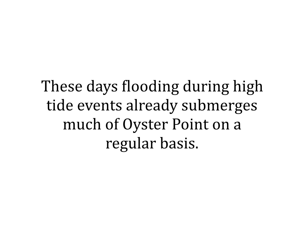
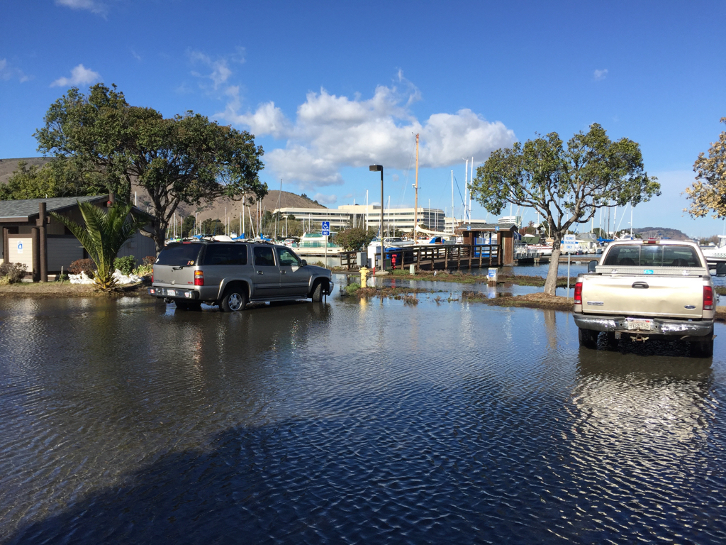
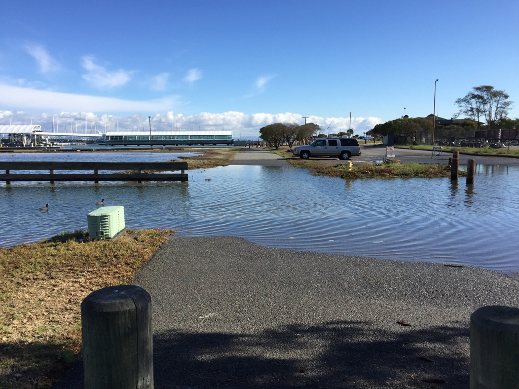
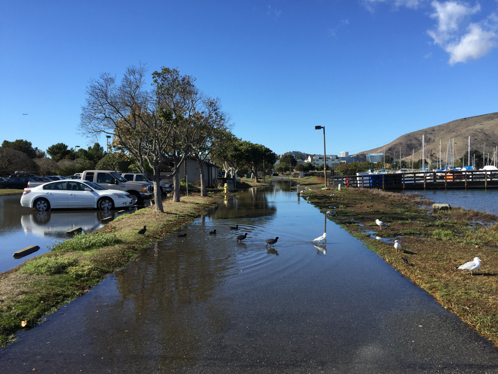
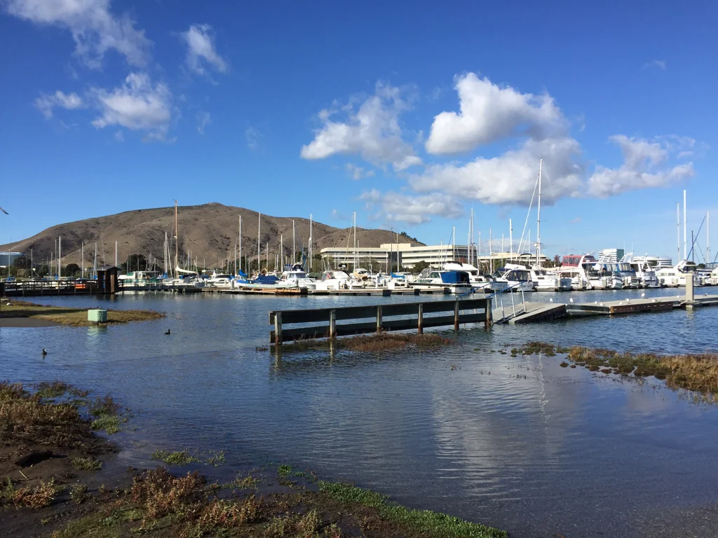
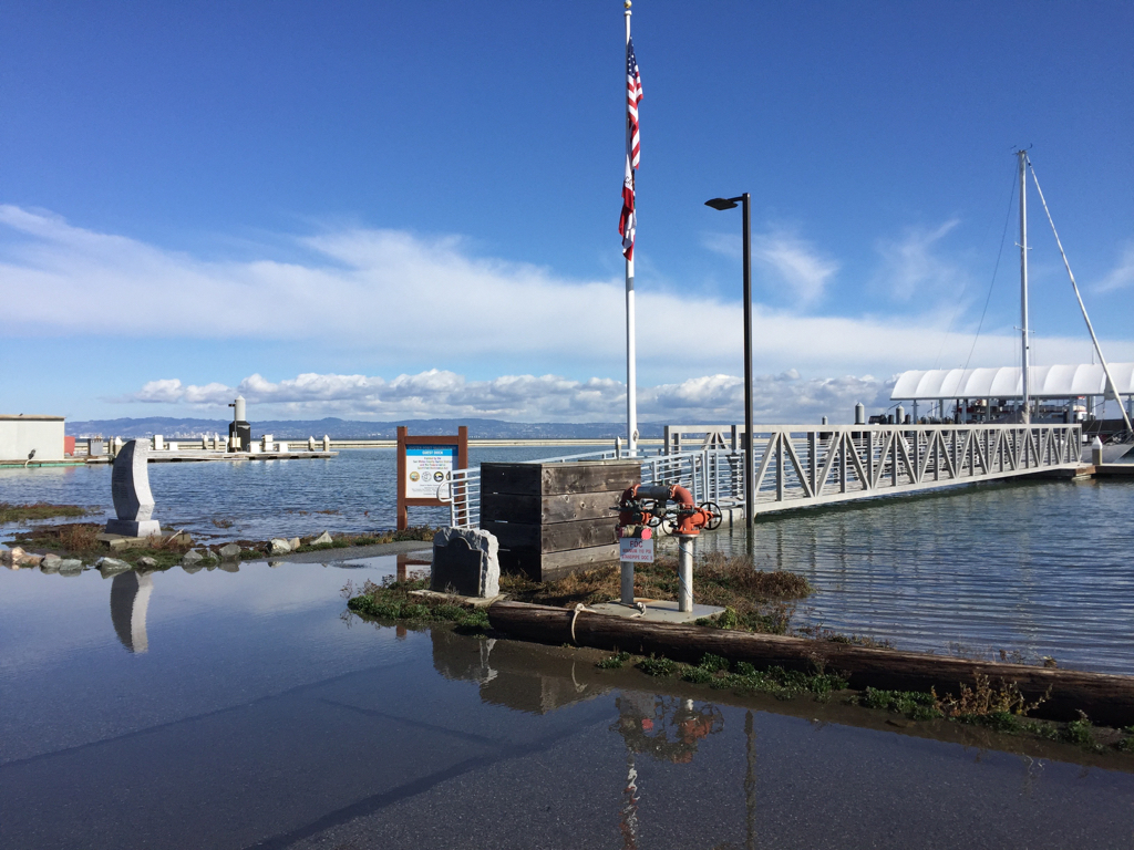
Oyster Point Marina Underwater
Please checkout my presentation about chronic flooding at the Oyster Point Landfill.
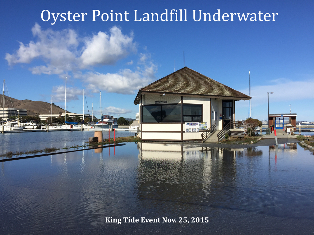


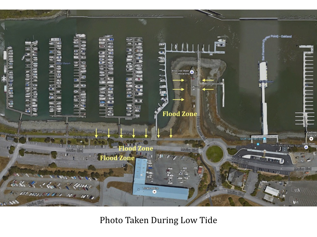

The map below indicates the area the color photo were shot.
Please click the map to see a larger version. The map photo represents a low tide.
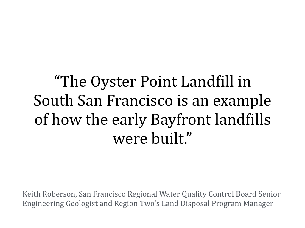
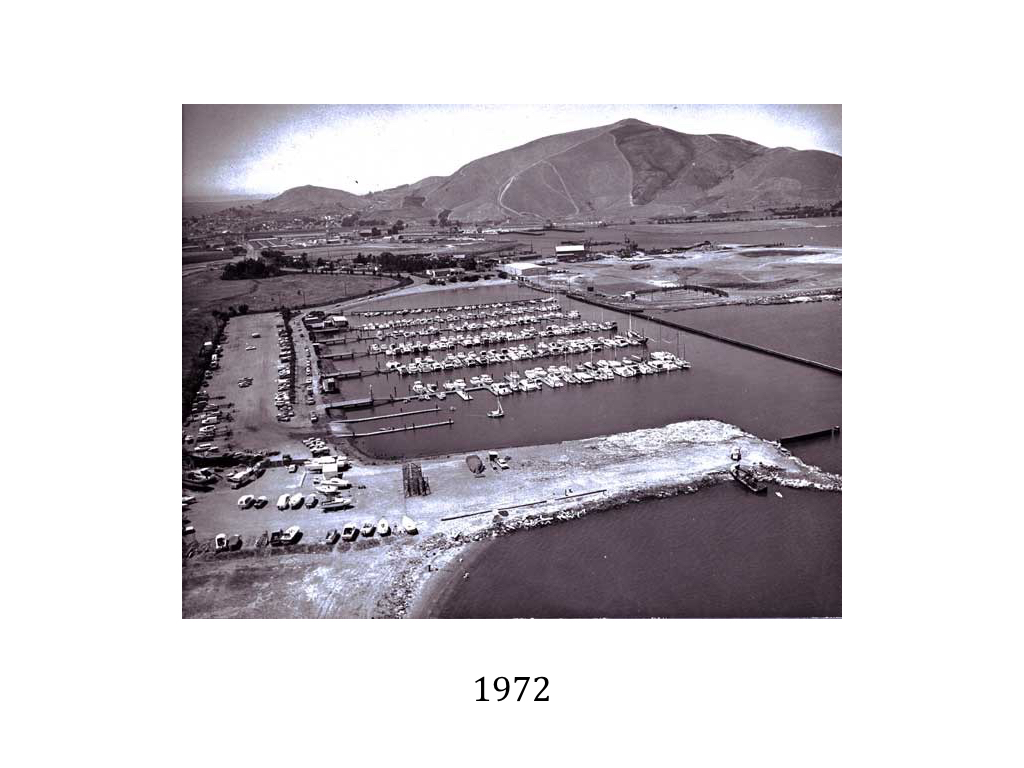
Oyster Point Marina is result of Bay fill dump era

Trash Dumps and the Hidden History of the Bay Shoreline
First there were marshes; then there were dumps. The dumps were eventually turned into regulated landfills, and the landfills into shoreline parks.
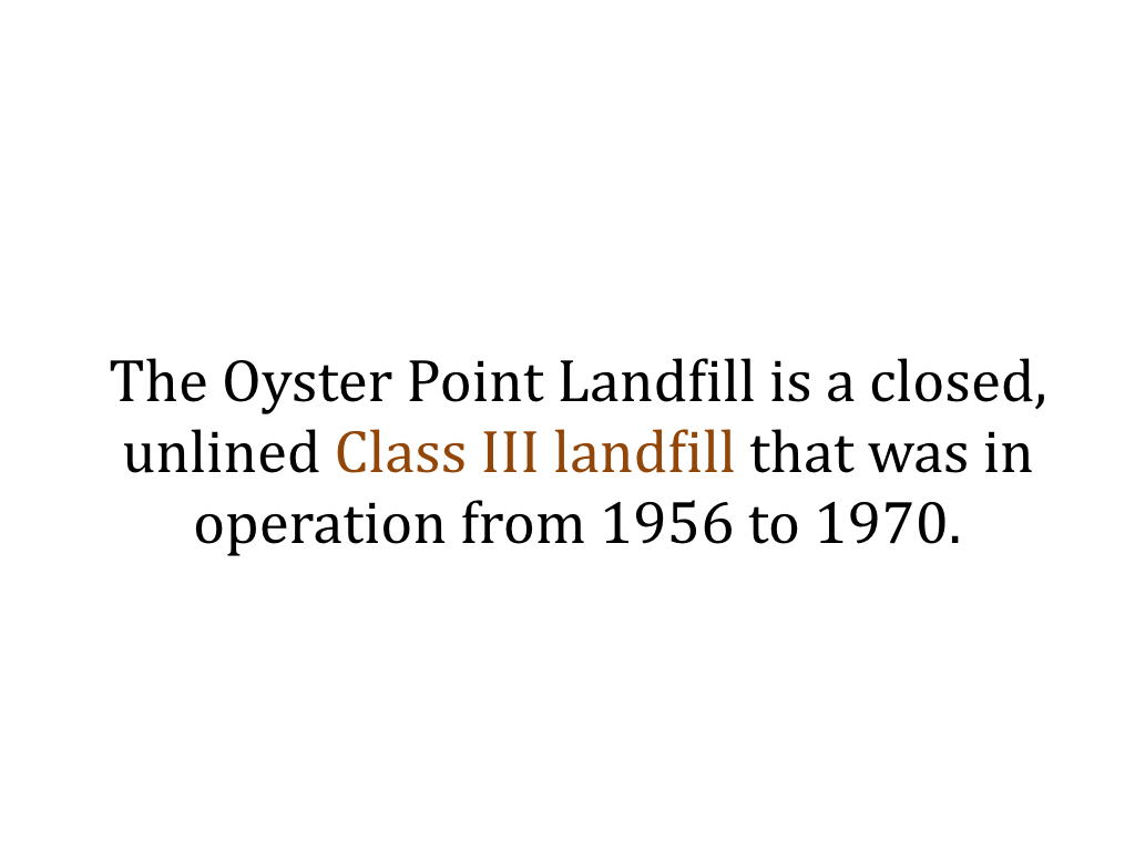
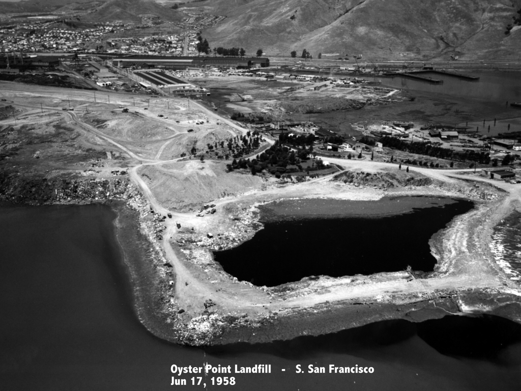
The Oyster Point Landfill is a closed, unlined Class III landfill that was in operation from 1956 to 1970. Prior to 1956, what would become the Oyster Point Landfill area consisted of tidal marshlands and upland soils and bedrock.
Between 1956 and 1970, the City of South San Francisco leased the site (approximately 57 acres) to South San Francisco Scavenger Company.
In 1956, Scavenger began disposal operations at the landfill. Initially, municipal solid waste was disposed of on the ground and burned. This activity ended in 1957 following the enactment of laws prohibiting open air burning of rubbish in the Bay Area. To address the new air quality restrictions South City and Scavenger established a solid waste disposal site on the submerged lands just east of the original Oyster Point.
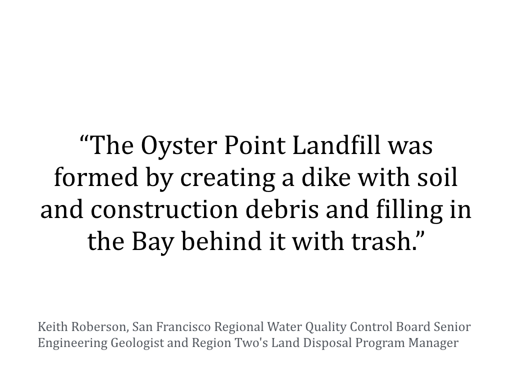
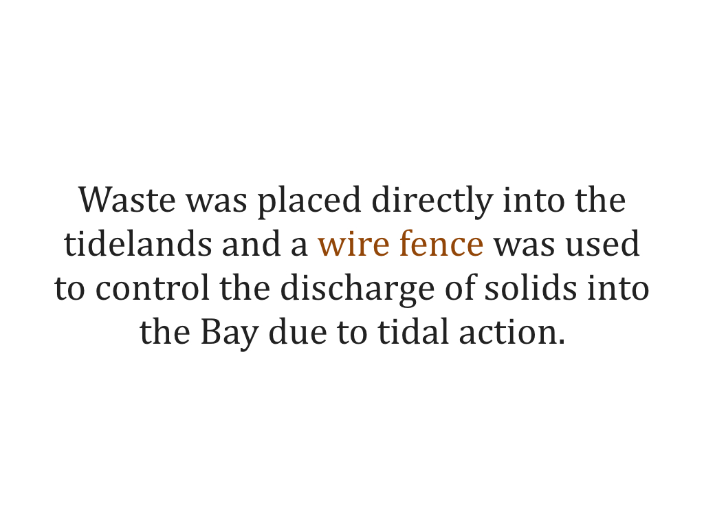
The landfill was developed in three phases. Filling of the first section began in 1957 and was completed by late 1961. The first area to be filled extended into the Bay about 1,500 feet eastward from the original bluff. Scavenger placed waste directly into the tidelands and used a wire fence to control the discharge of solids into the Bay due to tidal action. Waste disposal operations eventually resulted in the relocation of the shoreline approximately 3,000 feet to the east of the pre-landfill shoreline.
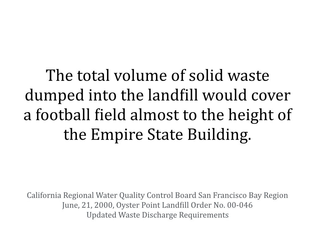
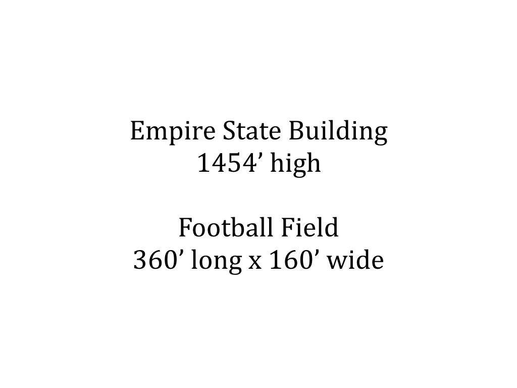
The landfill material consists of up to 45 feet of poorly compacted municipal and industrial waste. Typical waste found within the landfill includes the following: chemicals, drums, paper, cardboard, organic matter, wood, glass, metal, rubber, rocks, concrete, and other materials. The base of the landfill material has been compressed into, and mixed with, the upper part of the Bay Mud. The volume of waste in the landfill is approximately 2.5 million cubic yards and total tonnage of this material is approximately 1.4 million tons. This volume of waste would cover a football field almost to the height of the Empire State Building.
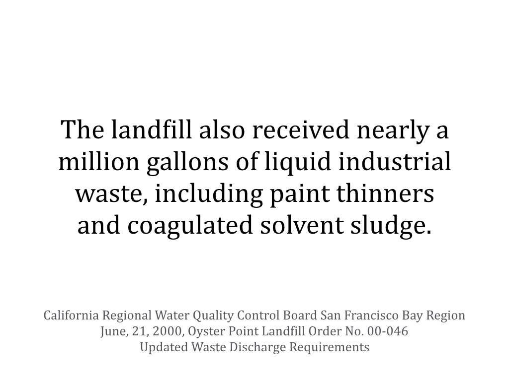
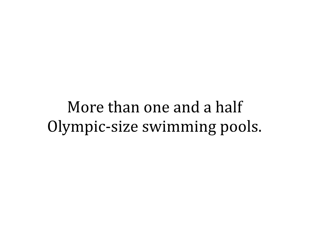
Beginning in 1961, the landfill received liquid industrial waste for disposal. The types of liquid waste included paints, thinners, and coagulated solvent sludge. The liquid wastes were placed in a sump (Sump 1). No records describing the construction of the sump have been found. Liquid industrial wastes were disposed of in this sump from 1961 until 1966. In July 1966, the City of South San Francisco discontinued the use of Sump 1 and used Sump 2 until 1967. The total volume of liquid industrial waste received by the landfill in 1965 and 1966 is estimated at 608,351 and 378,680 gallons, respectively. Sump 1 alone is almost enough to fill an Olympic-size swimming pool.
Consistent with landfill practices at that time, no liner was installed at the site. Waste disposal design features such as liners, cellular division of waste, and leachate collection systems were not installed. Instead, the waste materials were placed directly onto the Bay Mud and soils overlying bedrock. In order to contain the solid waste from contact with waters of the State, Bay Mud berms were constructed around portions of the waste disposal areas in 1961, 1962, and 1964. However, there is no data to suggest that the industrial waste sumps were ever constructed with additional berms or dikes to control the migration of liquid wastes.
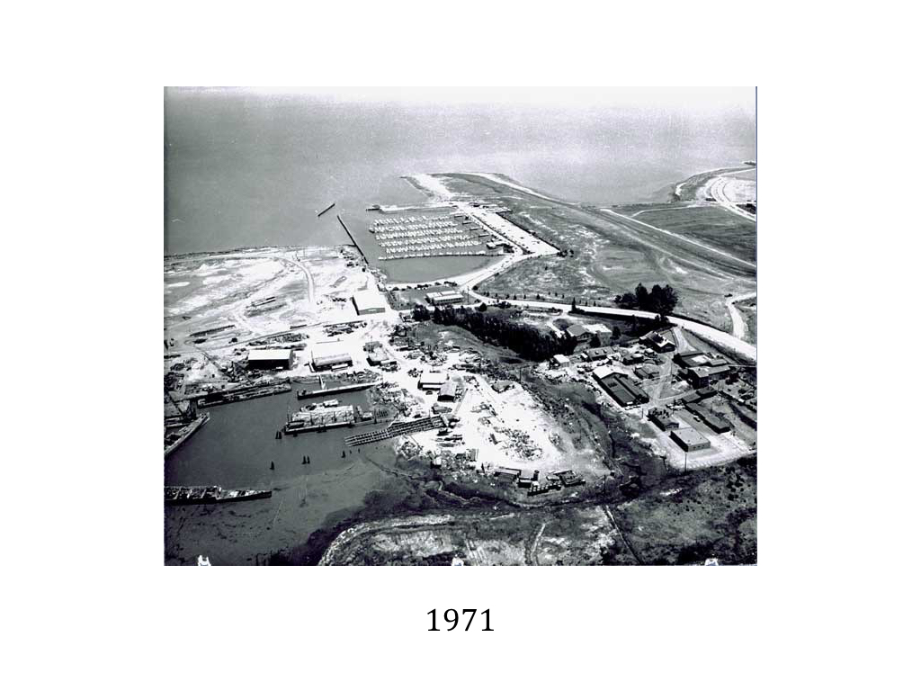
In 1962, a small craft harbor was constructed along the north shore of the landfill. To create a breakwater for the east side of the marina, the second phase of landfill was placed in the form of a mole extending from the eastern end of the first fill and north about 400 feet into the Bay. The third phase of filling began in 1964 and was accomplished by dredging up Bay Mud and forming mud dikes and a dike-enclosed cell in which solid waste was later placed.
Upon completion of the disposal operations, various landfill closure activities took place through the late 1980s. The closed landfill then became the site for development of the Oyster Point Marina/Park.
The landfill is currently owned by the City of South San Francisco and is operated as a marina, ferry terminal, yacht club, hotel, office space, and open space. South City is responsible for landfill maintenance and the San Mateo County Harbor District manages marina operations pursuant to a Joint Powers Agreement that terminates in 2026.
South City hopes to redevelop the site. The 2015 Semiannual Oyster Point Landfill Report states that a project would include excavation of landfill materials at the former Oyster Point Landfill and relocation of these materials on- and/or off-site. The landfill cap would be upgraded to meet the current requirements of Title 27 of the California Code of Regulations with the approval of the Regional Water Quality Control Board and San Mateo County Environmental Health Division.
The first phase of redevelopment plans call for up to 600,000 square feet of office/R&D space, envisioned as a biotech campus, and possibly a retail/restaurant building, in the area currently occupied by the existing commercial development at the eastern side of the landfill site. Phase I also includes the reconfiguration of Marina Boulevard and a portion of Oyster Point Boulevard, and a shuttle turn-around will be constructed adjacent to the Ferry Terminal. Parcels to the east of the new development will be graded and improved as sports fields. Further east a future hotel and retail complex is envisioned. The existing Yacht Club structure and the Harbor District maintenance building would remain.
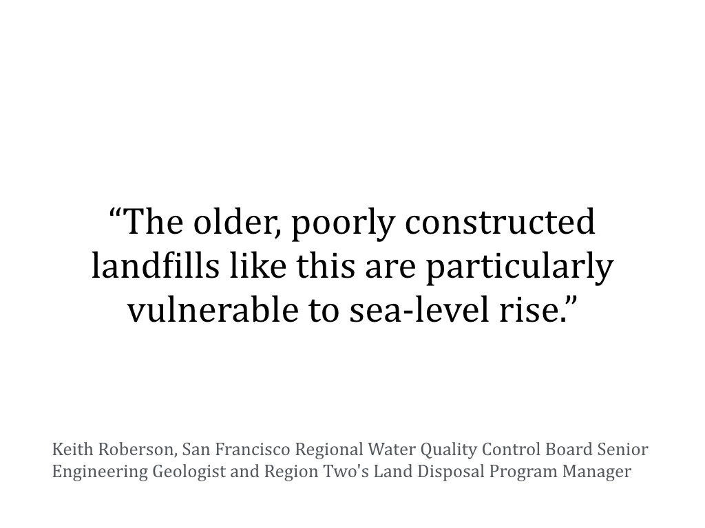
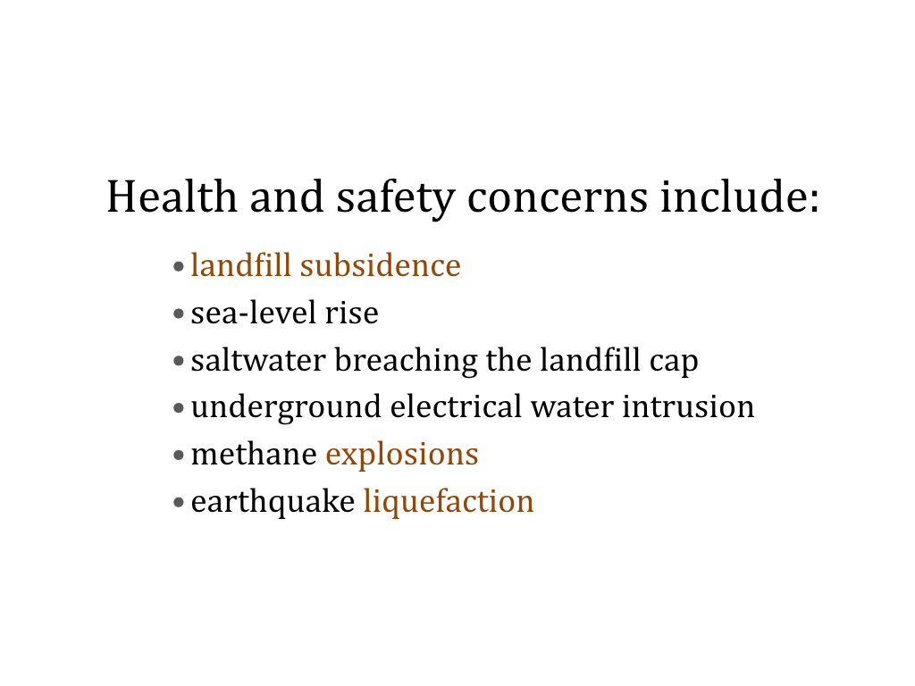
Where is the wisdom in developing such a risky site? Health, safety, and public access concerns include flooding from landfill subsidence and sea-level rise, Bay saltwater breaching the landfill cap, underground electrical saltwater intrusion, gas explosions, and liquefaction.
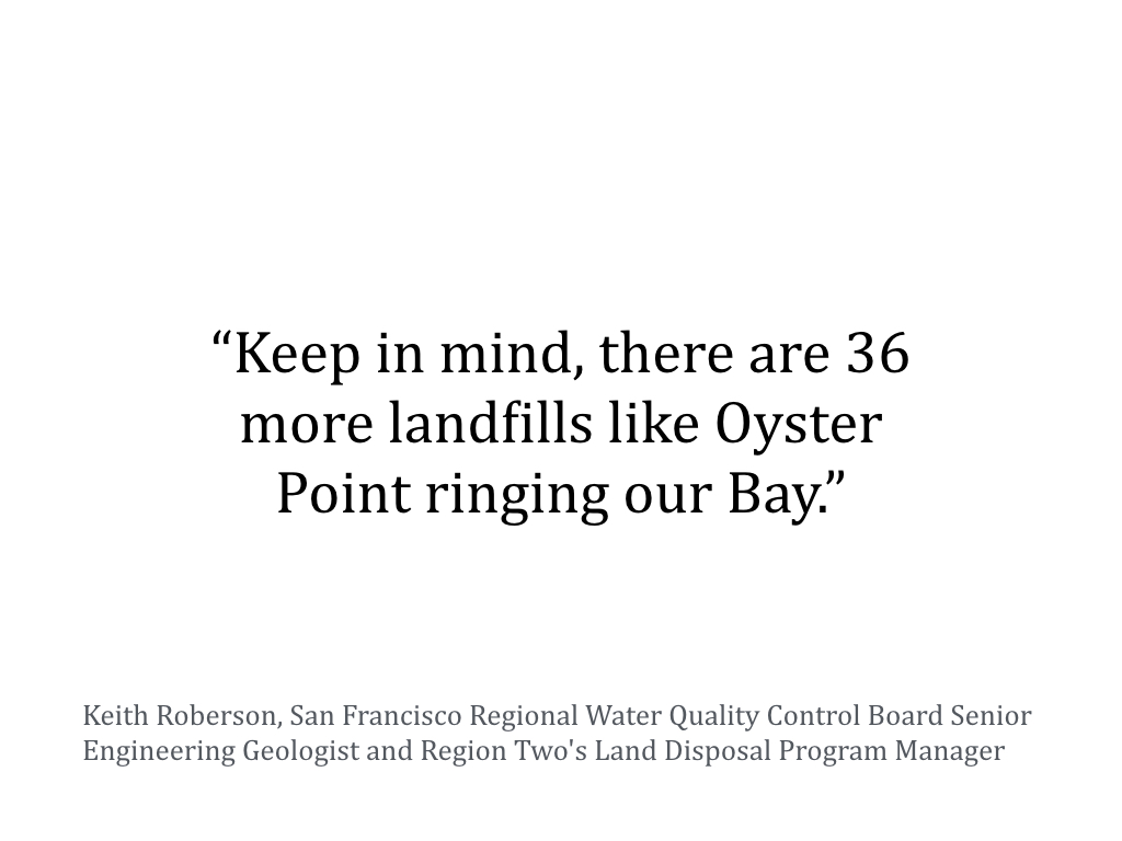
On Dec. 9, 2015, Bruce H. Wolfe, Executive Officer of the San Francisco Bay Regional Water Quality Control Board sent the City of South San Francisco an enforcement letter regarding recurrent flooding overtopping the landfill cap. The San Francisco Regional Water Quality Control Board, San Mateo County Division of Environmental Health, and Bay Area Air Quality Management District are the agencies that regulate the landfill.
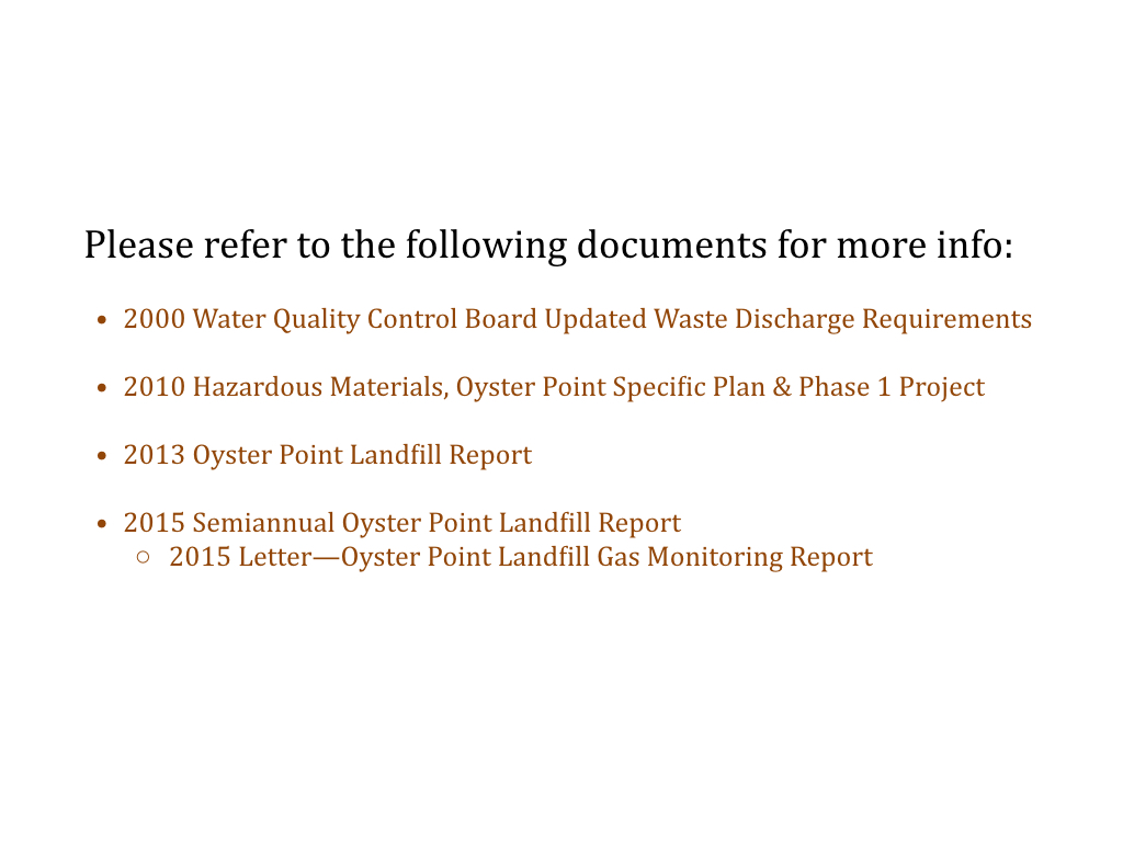
Refer to the following documents for more info:
2000 Water Quality Control Board Updated Waste Discharge Requirements
2010 Hazardous Materials, Oyster Point Specific Plan & Phase 1 Project
Jan 30, 2016 — The SMC Office of Sustainability removed Oyster Point Landfill from the list of recommended assets. The change was disclosed at the County’s SeaChange Open House at Genentech in South San Francisco. The City of South San Francisco informed the County that they would prefer Oyster Point Landfill not be included in the Army Corps of Engineers funded SLR Vulnerability Assessment. The County responded by removing Oyster Point Landfill and replacing it with a landfill located in Half Moon Bay approximately 100 feet above the ocean.
Feb 26, 2016 — City of South San Francisco short-term plan for mitigating flooding at Oyster Point Marina caused by landfill subsidence and sea level rise. See Figure 5 in the Report. It appears that sea-level rise projections have not been calculated or included in the topographical mapping yet.
Oyster Point Landfill, City of South San Francisco, Requirement for Submittal of Technical Reports Pursuant to Water Code Section 13267
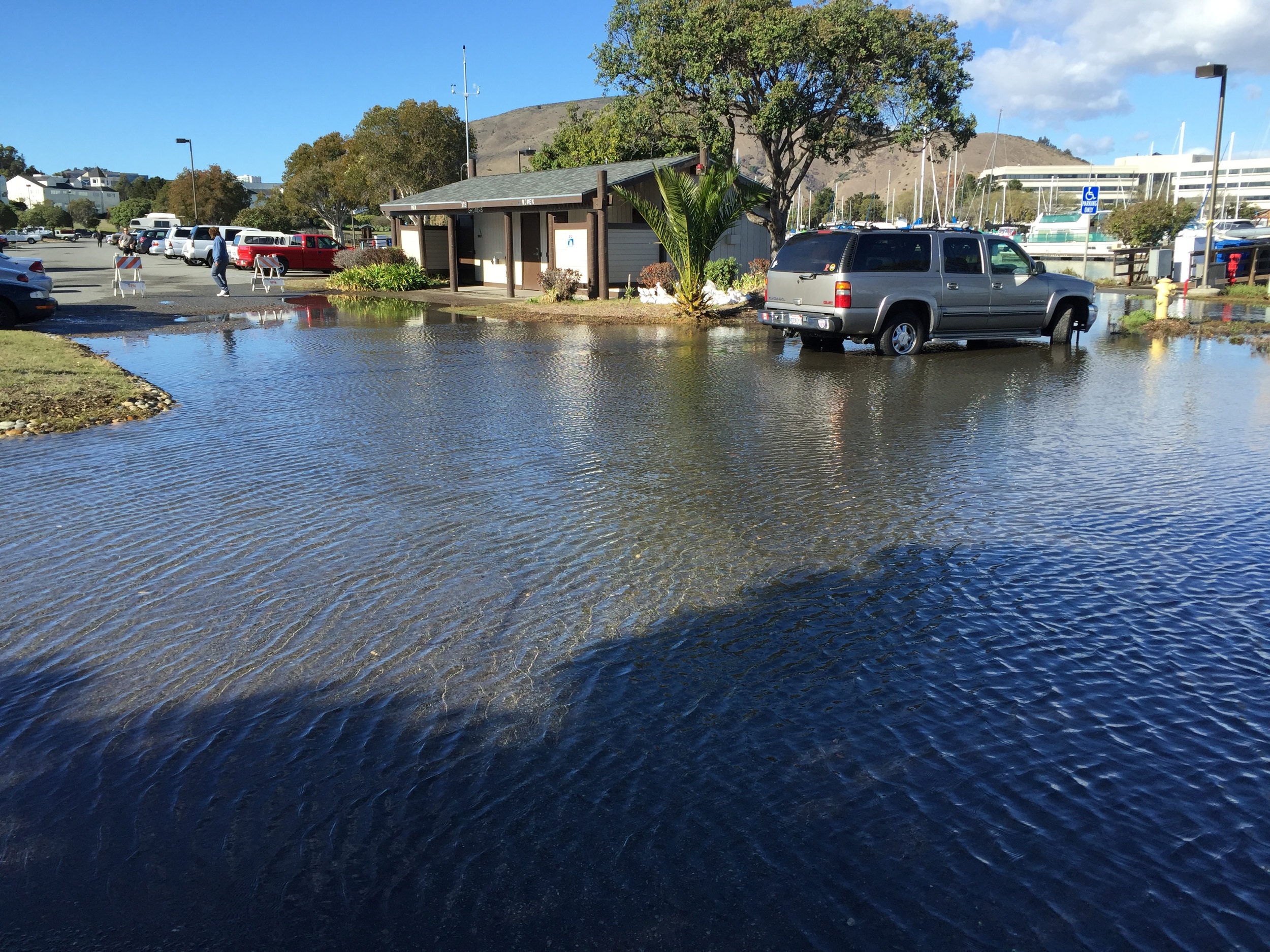

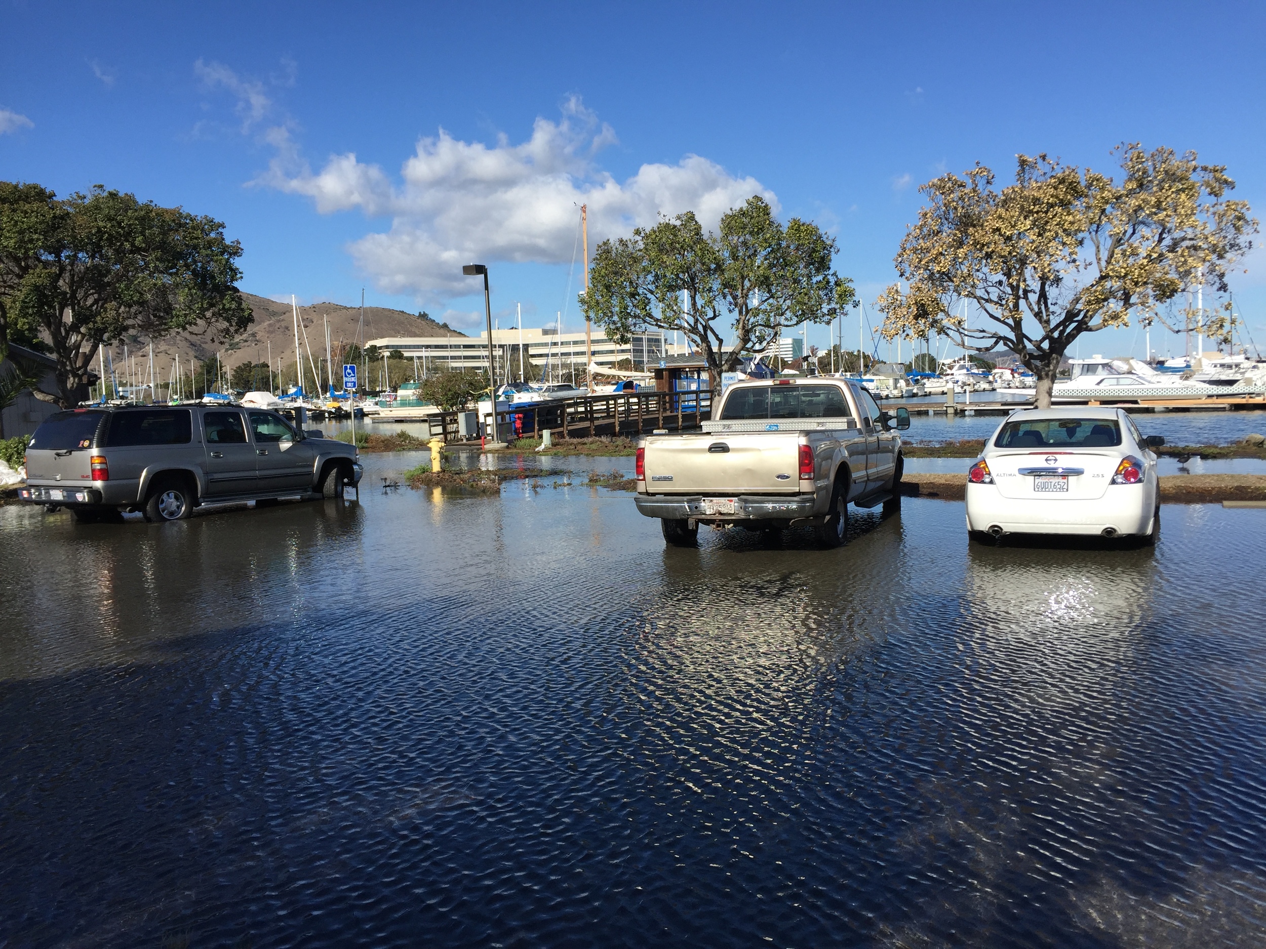


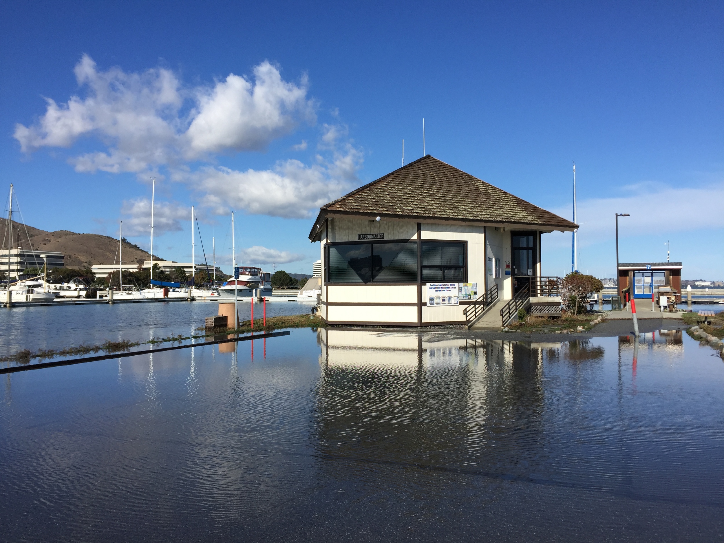

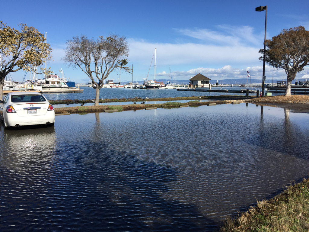
King Tide flooding at Oyster Point Marina—Wed., Nov. 25, 2015